Creating Maps and GPS Coordinates
Overview:
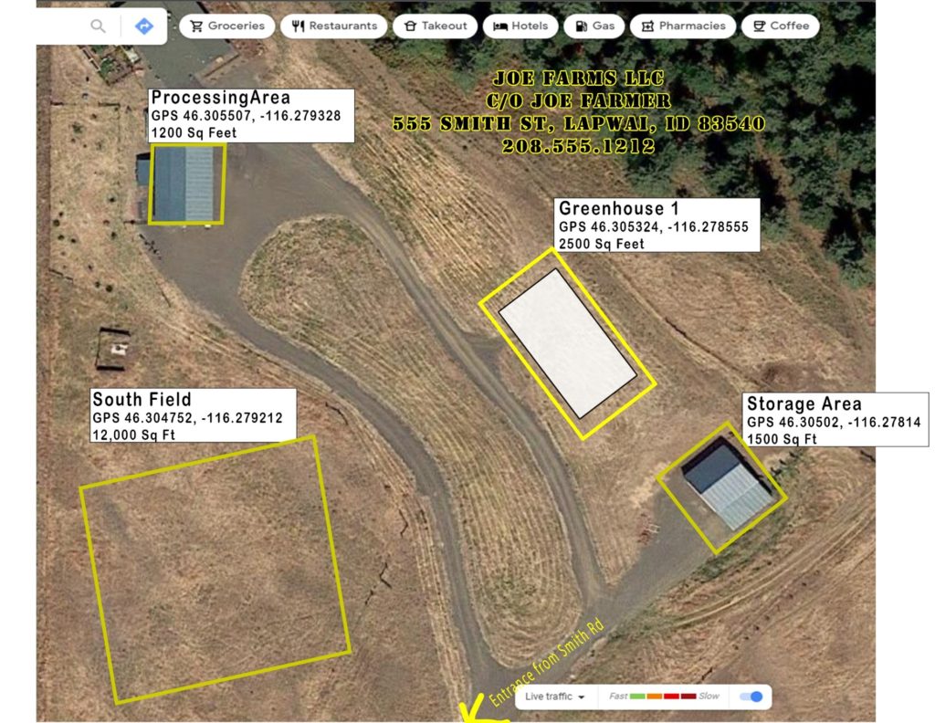
A color photographic map is required for each growing, storage, handling or processing location and must contain the following:
- Applicants name, and if applicable, the business name printed on the map page;
- Physical address of the location;
- Expanded view to show the site, a public roadway and the road name;
- Outline of the location of each contiguous planting;
- Location ID/name for each field, greenhouse, indoor growing, handling, storage or processing structure, and
- Acreage of each contiguous planting.
Recommended Map Programs:
The Nez Perce Tribe Agriculture Office (NPAO) prefers all maps be created with a formal map program. NPAO does not advocate for specific programs, however, the following programs are acceptable options:
- Google Earth
- Google Maps www.googlemaps.com You will be presented with a satellite map with a text entry field in the upper left corner. You can enter an address or GPS coordinated into this field.
- Map Quest www.mapquest.com You will be presented with a satellite map with a text entry field in the upper left corner. You can enter an address or GPS coordinated into this field. On the right side, middle of the page, select the “satellite” button to convert the map to imagery.
The map should show at least one nearby road, the entrance to the site, and the identification of the hemp locations.
Once you are satisfied with the level of zoom, print out, or save the map as a document.
To label the map on a computer, please follow the steps below.
- For maps created in Google Earth you can save the image to a Microsoft Word Document and add text boxes for the required information.
- To add a text box, click in an area outside of the map and choose “insert” and then “text box”.
- Enter the information into the box and move the text box into the appropriate area of the map.
- You may resize the map if needed.
- Repeat steps two through four as necessary.
- Finish the map by labeling it with the required information.
See map below for example of map required for Site Registration:
(Map complete with description of a contiguous field, and indoor structures.)
A printed map with hand-written labels is also acceptable